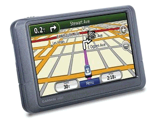
 If I were to assess a five-star rating to the GARMIN nüvi 205W GPS unit that we took on our vacation, I would give it a 3½ star rating. Our vacation route took us a distance of over 700 miles, starting from Carson, California (where we picked up the 24 foot travel trailer).
Our first stop was in Buellton, north of Santa Barbara. After exiting US Highway 101, the GPS gave us flawless directions to our first waypoint. Yours truly, made a wrong turn off the highway, but the GPS recalculated and we were quickly on a bee line for the RV park.
The next morning we continued northbound on 101 to San Luis Obispo where we made a left turn to head over to the coastline at Morro Bay. I had the GPS programmed to take us to the RV park at Morro Dunes. When we got there, the GPS wanted me to overshoot the campground entrance by only a couple hundred yards, but it wasn’t exactly at the entrance like the night before. We pulled into the park and backed the trailer into our assigned spot.
The weather at the beach was cold. (Where is that global warming when you need it?) After walking around the area, Verna decided she needed some sweatpants or something since all she had with her were dresses and shorts. “No problem,” I said, “we can look up shopping on the GPS.” I confidently loaded a shopping>sporting goods ‘point of interest’ into the destination queue and off we went.
We headed down a frontage road by State Route 1. The GPS kept telling us to turn left, which was impossible due to the seven-foot chain link fence between the frontage road and the highway. When we were finally able to go left, the GPS directed us into a housing tract and pronounced arriving at destination in front of a house on a cul de sac (*FROWN*).
It was at this point, Verna says that I started arguing with the female voice – a habit that continued the rest of the vacation until I finally muted the bitch voice function. During the misguided adventure, we passed a surf shop and stopped there to get the garment for Verna on our way back to the RV park.
The next morning, we went into town to get some things and to refuel. I used the map function just to know where the main drags were – they’re highlighted differently than side streets. That worked out pretty well – we got our stuff and fueled up all in the same place. Back at the campground, we hitched up the trailer and headed up SR 1 toward Big Sur, Carmel and Monterey. An Arduous haul with the rig, for sure, but the scenery is breathtaking and well worth the drive. The map in the GPS display showed the bends in the road before we got there – that was pretty cool.
Heading for the next RV park, in Aromas, California, near Hwy 101 again, the GPS got us to the wrong place – my fault – I entered the wrong address and it correctly took us there. When I entered the correct address, then it took us to the wrong place, about ¾ mile south of the real place it turns out. I called the RV park on the wireless and got verbal directions. I presume it’s an error in the map database since Google Earth also showed me the same (wrong) place.
To make a long story even longer, I could describe the rest of our drive in detail, but the GPS acted as advertised, guiding us to a supermarket, to get gas, to the next campground in Paso Robles, and the last day to our home in southwestern L.A. County.
Overall I’m pleased with the new toy. I will have to assume there are bugs in the database here and there, and plan accordingly, when we take our next drive.