 One of our activities is, and has been for quite a while (since living in California) watching the International Space Station fly over when visible. Last Sunday night’s pass was quite a treat in that it had nearly everything going for it: cloudless skies, convenient timing and an almost direct overhead pass.
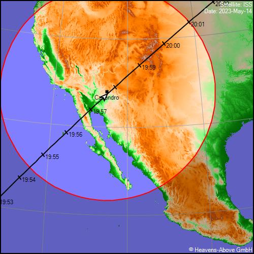
In the image above, you can see the ground track of the ISS as it passed over the Southwestern US. The maximum predicted elevation for this particular pass was 88° which barely missed our exact location to the southeast, but watching the fly-over, one could not perceive any difference from a direct overhead pass. Image credit Heavens Above.
Another attribute that is not always the case during a pass is that the ISS remained sunlit during the entire pass. We live in a slight hollow below surrounding terrain and saw the ISS rise in the southwest above some local hills and it few over us and set in the northeast behind some other terrain. We always enjoy watching the ISS and other satellites flying over, but this one was unusually spectacular.


