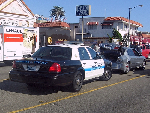
Two concepts of headaches:
- being in an accident at rush hour
- inching through traffic in the aftermath of an accident
I’ll take 2 any time . . .

Seen on my evening commute through Hermosa Beach.
Two concepts of headaches:
I’ll take 2 any time . . .

Seen on my evening commute through Hermosa Beach.
Once home to the pre-Colombian Sinagua Native Americans, the ruins at Tuzigoot, near Cottonwood, AZ, is a very interesting place to visit. It was a stop on our tour through Arizona last month. This is a picture of the ruin as seen from the road leading up to the park entrance. I’d like to take credit for this panorama, but it actually is a shot that Verna took from the truck as we drove up to the ruin. I cropped the image for this widescreen view.
Last year, I took a panorama of the Manhattan Village Mall. This week, I took another panorama from the same place, but wider and in better lighting conditions.
Click the pic for big.
Not far from where I work, there is a golf course and a tennis club. In the bad old days, these both were just a cleared out area where the power lines and their unsightly towers ran through on their way from the electric power plants in El Segundo and Playa del Rey on the way to distribution points east.
Planners decided at some point that the wires were not a desirable feature and found a way to run these high wires underground. I took this panorama from the east end of the subterranean power line run to the west end where the towers resume. You can see the lines disappearing as they plunge into the ground at the near end. The golf course is directly behind the tree line along the street running from left to right. I circled the west tower where the lines come back up about a half mile in the distance on the far right end.
I sometimes walk down to this end of the run from the building where I work, which is at the far end of the run in this picture. About a mile round trip and a good after lunch walk.
We’re still digging through the vacation pictures and I found this shot of a bend in the Colorado River – at the bottom of the Grand Canyon. I used my Canon A710-IS camera with maximum optical zoom of 3x. You can see sandy beaches along the riverbank beside the muddy river where the ancient peoples of this region spent the winters to escape the cold temperatures at the rim. Click image to enlarge.