Panoramas

Before the Monsoon Panorama

Before the Monsoon Panorama

You can already see the mid-afternoon cumulus clouds building up over the house in this panorama. Two hours later, it was pouring rain on this sunny location as the clouds continued to build into what turned out to be a nice, but badly-needed rain shower.

So far this summer monsoon season, we have only had the bare necessity rain without the flash flooding in our area. We think that if the heavy monsoons hit that we will be OK with our retaining walls and the new little creek that Verna and I fashioned out of rocks on the west side of the lot.

Agave Flower Stalk

Agave Flower StalkThere is a giant agave flower stalk about five hundred feet down the road toward the pavement from our place. We have been watching it grow over a couple of months and now, with the top looming over twenty feet in the air, its flowers are ready to open.

I took my Canon EOS Rebel SL1 on our daily walk down the road and snapped this photo of the picturesque flower chandelier high atop the stalk. I actually had to take two images, above and below, and stitch them together to render the composite at the right.

Click on the image to enlarge.

Wickenburg Bluegrass Festival

bluegrass-pan.jpg

Verna and I went to the 36th Annual Wickenburg Bluegrass Festival today. We didn’t stay long, but we enjoyed the music and shopping at the concessions set up on the rodeo grounds.

I took several images of the performance area with the crowd enjoying the music as the performers played. I stitched the images together to make this panoramic view of the event. Click on the image to view the full sized panorama.

Casandro Dam Basin

Casandro Dam Basin

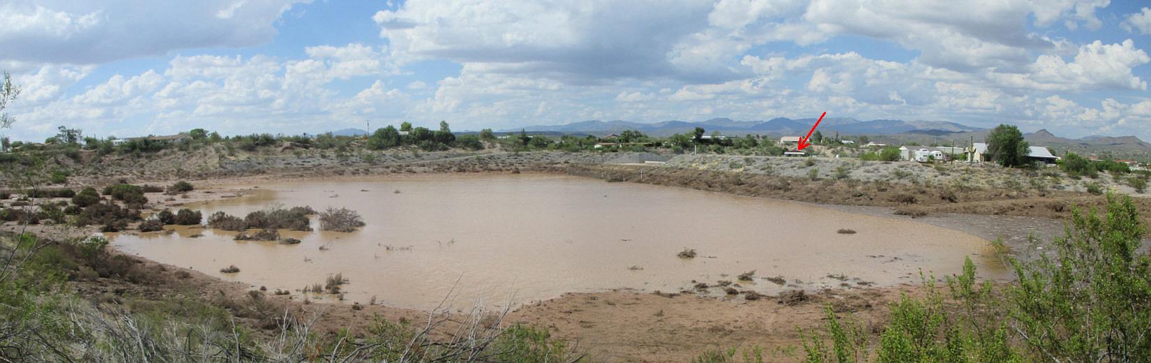
The afternoon after our big monsoon thunderstorm and record-breaking rainfall, Verna and I drove up the road to a vantage point near US 60 where the Casandro Dam catch basin can be seen. I caught this panoramic image of the basin with the water level at just about the ten percent full point. If you click on the image to enlarge, you can see the high water mark came up to the top of the spillway. There was a LOT of water that fell on our desert town.

We were OK since our house is protected by retention walls that divert the runoff around the house, but there were a couple of places where the muddy mess piled up on the concrete. That was easily fixed with a shovel, wheelbarrow and hose.

In the panoramic view above, the red arrow points to the approximate place where our house is located below the houses beyond. Click on the image to enlarge.

Vulture Mountain Panorama

Vulture Mountain Panorama

We took the dogs to the groomer today. While we were out running some errands, we took a very short drive out into the Vulture Mountains south of town. We seldom do this, but had some time since the dogs were otherwise occupied and we felt like seeing some of our wonderful desert scenery up close.

I composed this panoramic image along the roadside of a local mountain ridge with a rock outcropping on the left in the foreground and Vulture peak in the distance on the right. This view shows a saguaro-studded landscape with a sprinkling of teddy bear cholla and palo verde trees. Click on the image to view the full-sized panorama.

Panoramic Image Before Wall Work Starts

Before Panorama

Next week, if all goes according to schedule, the masonry crew will show up to start building four walls on the property. Two of them, a short one on the left of the RV drive and a longer one to the right will fortify the front of the landscape against the rushing waters we seem to get annually in monsoon season. The panorama above (click to enlarge) is the “before” view of the property.

The other two walls will be behind the RV drive out back and a shorter one in the wash itself to divert runoff to the little creek on the west side of the lot. Both walls are to prevent runoff from coming onto the RV drive in back.

I will try to post an “after” panorama when the work is complete.